We're betting this is the brief for an independent landscape studio to be hosted by Studio-X NYC and led by its newly appointeddirectors, one of their night schools in which participants from diverse fields such as computer science, geography, botany, meteorology, statistics and geoinformatics meet together to sketch out an algorithm for ecological totality.
It is common today for even consumer-grade cameras to tag the images and videos that they capture with the location of the image on the earth's surface ("geolocation"). However, some imagery does not have a geolocation tag, and it can be important to know the location of the camera, image, or objects in the scene. For this imagery, analysts work hard to deduce as much as they can using reference data from many sources, including overhead and ground-based images, digital elevation data, existing well-understood image collections, surface geology, geography, and cultural information. Such image/video geolocation is an extremely time-consuming and labor-intensive activity that often meets with limited success.
Several research and consumer-oriented systems have developed useful and relevant capabilities using techniques that include large-scale ground-level image acquisition, crowd sourcing, and sophisticated image matching. These largely automated systems tend to work best in geographic areas with significant population densities or that are well traveled by tourists, and where the query image or video contains notable features such as mountains or buildings.
The Finder Program aims to build on existing research systems to develop technology that augments the analyst's abilities to address the geolocation task. Required technical innovations include the 1) integration of analysts' abilities and automated geolocation technologies to solve geolocation problems, 2) fusion of diverse, publicly-available, but often imperfect data sources, and 3) expansion of automated geolocation technologies to work efficiently and accurately over all terrain and large search areas. If successful, Finder will deliver rigorously tested solutions for the image/video geolocation task of any outdoor terrestrial location.
To sign up, visit the website of who we believe to be the studio's sponsor, the Intelligence Advanced Research Projects Activity (IARPA), an agency described as the DARPA for the intelligence community.
A few years ago, in a patch of California forest, researchers were “linking up more than 100 tiny sensors, robots, cameras and computers,” giving them “an unusually detailed portrait of this lush world, home to more than 30 rare and endangered species.”
Wireless motes, cameras and other sensors track the nesting habits of birds, the life cycles of moss and the carbon dioxide uptake of various soils. Robots move along wires strung from tree to tree, lowering sensors to take temperature, humidity and light-level readings at different levels.
So when a tree falls in the forest, they will hear it. Always. In real-time. And over the internet.
If you allow us to indulge ourselves for a moment, we're reminded of that scene in Red Planet (2000) in which Val Kilmer, stranded in the extraterrestrial wilderness of Mars but incredibly near the Mars rover Sojourner, used parts of the robot to construct a makeshift radio to communicate with a fellow astronaut still in orbit. A rescue plan is hatched, after which he has some run-ins with a rogue robot, stumbles into a swarm of oxygen-excreting native Martian insects, and saves the Earth because of that discovery.
Stranded in the terrestrial wilderness of the forest but again incredibly near a smart patch, Val Kilmer will again cobble together a makeshift radio but this time out of dormant tiny robots to communicate with a fellow hiker still at the trailhead. A rescue team is dispatched, after which he has some run-ins with a rogue treebot belaying and gliding from treetop to treetop, stumbles into a swarm of climate change data saved by but not downloaded from the network, and saves the Earth because of that discovery.
Returning to the first smart forest, when it was being implanted with sensing devices, “the field [was] young.” There was “an emerging world of very large networks that combine motes and portable gear with larger technologies to improve the depth, duration and range of monitoring.”
Among these very large networks was the $200-million EarthScope, planned to comprise of “3,000 stations that are to track faint tremors, measure crustal deformation and make three-dimensional maps of the earth's interior from crust to core. Some 2,000 more instruments are to be mobile - wireless and sun- or wind-powered - and 400 devices are to move east in a wave from California across the nation over the course of a decade.”
Another one is the $500-million National Ecological Observatory Network, or NEON, which then envisioned to include “15 circular areas 250 miles in diameter, each including urban, suburban, agricultural, managed and wild lands.”
Each observatory would have radar for tracking birds and weather as well as many layers of motes and robots and sensors, including some on cranes in forest canopies. If NEON gets a green light, construction is expected to start in 2007 and last five years.
One goal is to track invasive species, which cause more than $100 billion in agricultural losses each year. Another is to forecast changes in the biosphere that may accompany climate shifts so planners and government officials can make better choices about land use and restoration.
One wonders to what extent these networks were implemented over the years. How much of the $1 billion the National Science Foundation saw itself spending on these ecological projects did it actually dole out? Are there now, together with Charlie Sheen's global-spanning blanket of missives, layers upon layers of eco-data giving us a totalizing view of the entire planet?
Among the directives outlined in China's new five-year defense plan is the creation of a smart dust surveillance network. This will be comprised of speckle-sized devices that can sense environmental conditions, such as light, temperature and humidity. More importantly, they can gather civilian and military intelligence. Their tiny dimensions mean they are difficult to detect and can squeeze through the narrowest of gaps in doors, windows and walls. They can communicate with each other wirelessly, as well as transmit data to a nearby command center or remote satellite.
Dust, already pervasive and a nuisance to allergy sufferers and the obsessive compulsive, will become even more intrusive, as invasive as sand in your crotch. They'll gather on tables and floors, collect in corners and in your hair, where they'll rest silently listening for aberrant civility. In such a domestic space relinquished to the state, dusting, vacuuming and other quotidian chores turn into political acts of subversion.
Meanwhile, for cross-border espionage, artificial weather stations in the Gobi Desert will churn and whirl up massive dust storms. It'll simply be a matter of turning on the spigot. Hit the switch, and the earth will reach out with vaporous tendrils. When these have nicely thickened, a liberal sprinkling of smart dusts will be added to create a heady stew, which in a day or two will paint vermillion skies over Beijing before crossing the seas and choking the cities of the Koreas, Japan and, much further afield, the Pacific coast of the United States.
Specifically, Greek swimming pools. We are always reminded of them now whenever we hear news of the financial crisis plaguing Eurozone member countries. Every time, without exception, news of property market bubbles, sovereign debt, IMF bailouts, governments collapsing and violent street protests, including pipe bombs set off by domestic anarchists, not only from Greece but also from Ireland, Portugal and Spain — they inevitably conjure up Suprematist images of shimmering Aegean exclaves.
This is because, as reported by Spiegel last year, Greece has been using creative ways to boost tax revenues and lessen the country's crippling government deficit. These include using Google Earth to find the swimming pools of tax cheats.
Using police helicopters, Greece's financial crimes squad “fly over Athens' affluent suburbs and make films of homes owned by doctors, lawyers and businesspeople. They use satellite pictures by Google Earth to locate country villas, swimming pools and properties. And these tactics have revealed that the suburbs didn't have 324 swimming pools, as was reported, but rather 16,974.”
...which can abruptly make a detour to George Clooney...
If you haven't already heard, the Hollywood superstar contracted malaria while on a trip to Sudan earlier this month. He was there to observe the voting for independence in Southern Sudan and to draw attention to any humanitarian abuses that might arise during and after the referendum. He has since been cured.
No doubt a far less physically taxing way to draw attention to any conflict is through another George Clooney initiative: the Satellite Sentinel project.
A collaboration between Google, the UNITAROperational Satellite Applications Programme (UNOSAT), Harvard University and celebrity-backed NGOs, the project hires private satellites to monitor signs on the ground that could indicate impending violence, such as troop buildup and movements. The images gathered by the satellites are being made public to let would-be aggressors know that the world is watching them.
“We are the anti-genocide paparazzi,” says Clooney.
...and further deviate halfway around the world to the Amazon rainforests...
Last year we read about the efforts of the Surui Indians in Brazil to protect their land reservation. “Almost three times the size of New York City,” their patch of the Amazon rainforest is constantly threatened by farmers, loggers, ranchers and gold miners from all sides. They've lost some of their forest to deforestation, but managed to save the rest.
In order to protect what's left, they've teamed up with Google to capture high resolution satellite images to better spot illegal activities on their land. Every inch of their forest will be mapped and displayed on Google Earth.
...before getting to the topic at hand: food.
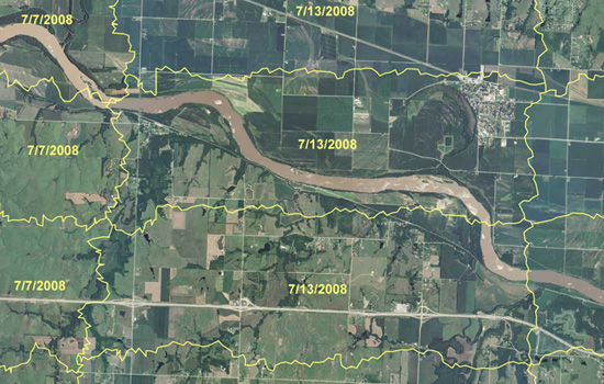
Tax collectors, tech-savvy indigenous tribes and George Clooney aren't the only ones using remote sensing and GIS applications to monitor and catch acts of criminality. There are also the crop cops at the U.S. Department of Agriculture's Aerial Photography Field Office.
Farmers may seem like trustworthy people, but the U.S. Department of Agriculture is taking no chances. It's spending tens of millions of dollars to create an enormous computerized map of every farmer's field in America. The program is intended to make sure farmers are doing what's required to earn their government subsidies.
It's an enormous task, keeping track of those subsidies. They add up to billions of dollars each year and they go to more than half a million farmers, scattered from Maine to California. Some farmers receive payments for protecting streams and wetlands; others, for growing specific crops. In each case, the payments depend on accurate information on the amount of land involved. So the USDA has resorted to a program of overhead reconnaissance — something akin of spy flights.
We mentioned this program, called the National Agriculture Imagery Program (NAIP), a couple of years ago when food prices were at record levels. Because farmers could earn more money by growing cash crops, they started converting the protective greenbelts back into croplands. In the fall of 2007, according to The New York Times, farmers “took back as many acres as are in Rhode Island and Delaware combined.”
Then came the global financial crisis of 2008, and food prices declined. But that decline, reportsGuernica, “seems to have been an anomaly.”
The December 2010 index of global food prices compiled by the U.N.’s Food and Agricultural Organization (FAO) hit a record 215, one point higher than in the spring of 2008. In fact, some food products, including sugar, cooking oils, and fats, are now trading substantially above their 2008 levels; others, including dairy products, grains, and meat, are inching perilously close to record levels.
So we'll we see more conversion of greenbelts into croplands? And will there be that one farmer who's going to keep their plump subsidies, courtesy of foreclosed and unemployed taxpayers, while plowing yet even more riches from destroyed wildlife habitats?
But what's a post without a (regurgitated) proposal: The Distributed Bureau of Agricultural Crime Investigation.
The problem with the National Agriculture Imagery Program is that there's just too many farms and too few analysts. Actually, we don't know if there are in fact too few analysts to pore through all those maps. It may be that just one cartographer is that's needed to comb through all the maps of Kansas and can do it in a couple of days.
But why not crowdsource it? Why not release the maps (that is, wikileak them, as they aren't in the public domain due to privacy matters) to the internet wilderness of distributed grid computing, data pornographers, meme-hungry social networking sites, open source virtuality and web-savvy eco-guerrillas?
It'd be like Einstein@home, a citizen science project which last year discovered a “disrupted binary pulsar” that may be the fastest-spinning of its kind. But instead of surveying the universe for distant remnants of supernovas, the teeming Web 3.0 masses use their collective clicking power to survey much nearer terrains. Imagine thousands of Google Earth addicts as citizen crop cops panning through digital screens in search of horticultural counterfeits, hours on end trying to spot cornfields where there should be reconstructed prairie or wetlands. This may even be the only time they get to interface with that other wilderness beyond the urban periphery — with Nature — for an extended amount of time.
Protecting your tax dollars while saving the environment — and enjoying the outdoors.
The coyote seen roaming around Downtown Chicago the other night may not be one of the pack fitted with GPS devices and let loose around the city “to help deal with rats and mice,” but learning that there is actually such a pack sent us into ecstatic fits.
According to researchers involved in The Cook County, Illinois, Coyote Project, there are over 250 coyotes fitted with radio collars now roaming the streets, parks and backyards of the metropolitan area. This is “the largest urban study of coyotes in the world.”
We have tracked the coyotes day and night and located the collared coyotes more than 40,000 times. This allows us to peek into the hidden lives of urban coyotes. We use results from this unique project to answer common questions regarding coyotes in urban areas. Many aspects of coyote ecology have direct management implications. Although our study was focused on Cook County, Illinois, we believe the things we have learned about coyotes and people living together are indicative of many metropolitan areas in the Midwest and eastern United States.
Set up an API to give mobile software developers a way to access those radio pings, and there might be apps to track the coyotes' urban ramblings. Google Coyote®. And yes, we're betting that it will have an audience. It's no different than nature webcams and participatory GIS platforms, like Google Earth, both of which have sizeable user base. It's also not uncommon for a lot of people to have their only extended contact with the wilderness mediated virtually. Make the interface slick, and the data pornographers and Tufte zombie acolytes will come in droves.
Develop it into an iPhone app, and you have the makings of an urban safari fad, as popular as birdwatching or urban GPS-tagged fruit harvesting. And to make it more interesting, that is, to approximate the conditions of a Serengeti safari, dial down the app's locative precision. Instead of giving you exact coordinates, it only tells you that the coyote is roaming somewhere in Hyde Park.
Touring the city in search of indigenous cyborg fauna.
Animal Architecture. With an interesting niche claimed, all it needs are more projects to post. Help them out with tips.
Delta National Park. John Bass blogs about the contested terrain of the Sacramento-San Joaquin River Delta, through which approximately 40% of water in California flows before entering San Francisco Bay and out into the Pacific. Liberally covered are aquapolitics, agriculture, hydro-infrastructure and other spatial systems, from small to large scales. Also be sure to check out the non-blog part of the site.
Subterranea Australis. One of those copy-paste blogs but we're glad it's returned after a summer hiatus, with a changed name, to copy-paste some more.
Tommy Manuel Blog. This interview with the photographer Harald Finster should help you dig in into the archives. The discussion centers on the aesthetics, documentation, preservation and rehabilitation of industrial installations.
For the past 3 years, a team of archaeologists, architects and computer scientists have been laserscanning the underground network of burial chambers, tunnels and chapels carved out of the soft, volcanic tufa rock of Lazio.
The scanner, according to BBC News, “looks like a cylinder on a tripod, stands a metre or so high and is a piece of kit you usually find in the construction industry.”
Gone are the days when archaeologists just used shovels, brushes and sieves to unearth the past.
The scanner has been placed in hundreds of different locations in the Catacombs.
It turns slowly, sending out millions of light pulses that bounce off every surface they come into contact with. The light pulses rebound back into the scanner and are recorded on a computer as a series of white dots, known as a "point cloud".
Gradually, every wall, ceiling, and floor is bombarded with the dots, enabling the computer to build up a picture of each room.
All told, “four billion dots” were gathered, and on a computer screen, they coalesce into a digital 3D model of the necropolis: a filigreed network of subterranean voids that's not unlike the complex clustering of a Romanesque basilica and its companion buildings.
You can zoom in and zoom out, rotate about the axis, and render it with color. Perhaps you can record your scopic drive through this digitized world, as one would with Google Earth. Give it a soundtrack, and you've got yourself a YouTube music video.
And maybe Radiohead would like to give it a go for a sequel to House of Cards.
One of the stated goals of the project is to study the paintings in the Domitilla catacombs: from the pagan images of the early 3rd century to the theologically fully developed Christian iconography of the late 4th century, and how this micro-history of early Christian art reflected the broader changes in late Roman society.
Now if only someone could make the laserscanner mobile (a spelunking Paranoid Android) and then send it roving through other labyrinths — other necropolises, ancient underground aqueducts, sewers, stormwater megatunnels, abandoned subway tunnels — kicking up an underground maelstrom of point clouds.
Google comes a-knockin', and soon everyone will be exploring these passages in a flurry of nighttime clicks. Google Hadesview®.
If blanketing UK cities with a thick scopic fog of CCTV cameras weren't enough, the countryside may soon find itself placed under similar heavy surveillance. But this, curiously enough, might be a good thing.
As reported by BBC News last month, researchers from technology firm QinetiQ and from Aberystwyth University flew an autonomous unmanned aerial vehicle (UAV) “over fields in England and Wales to map the nitrogen levels in soil, to determine whether fertiliser applications were needed.”
The data collected was then used to create a Normalised Difference Vegetation Index (NDVI) map, which “tells you the difference between 'green crops' that are photosynthesising and bare ground.” Where there is bare ground, more fertilizer may be needed.
Equipped with this NDVI map, some GPS locators and a techno-pimped out John Deere, farmers would thus be able to target areas in need of supplemental nutrients and to better estimate how much to use, potentially releasing less fertilizers that otherwise would leach out and pollute water sources down the hydrological line. This is precision farming.
Of course, you can use the same information-gathering technique to monitor other environmental conditions, such as soil moisture, disease outbreaks and pest population.
The ecological impact is potentially huge. Imagine only watering crops that need to be watered (and only when required) instead of flooding the entire field. Imagine as well spraying just those diseased plants with herbicides (and only when there is an outbreak) instead of suffocating acres and acres of fields with poison all the time. Better yet, you send in a cadre of Medusa agrobots networked to GPS satellites to surgically excise these botanical tumors.
With a surveillance network such as this, one wonders if you can re-purpose it to monitor other things, say, the urban poor doing a bit of nighttime grocery shopping while the food crisis and subprime armageddon rage on in the inner cities. When detected, they get sprayed with herbicides.
How about GMO crops? Design these neo-plants to emit a characteristic glow in the infrared or ultraviolet wavelength, and you can be alerted when they've jumped the fence. And don't forget to allocate part of the network to keep a look out for anti-GMO anarchists.
It's entirely possible that future pharms will be as heavily monitored as prisoners at Guantanamo Bay and as maniacally firewalled as CIA servers.
Meanwhile, how about using a similar surveillance network to monitor acts of agro-criminality?
As food prices have soared in recent months, farmers in the UK and in the U.S. have started to abandon conservation programs. Through these programs, farmers receive government subsidies for letting some of their fields lay fallow, but not as much if they were to now grow cash crops like wheat, soybeans and corn. Consequently, many of these uncultivated croplands, which have greatly helped restore wildlife habitats and reverse topsoil erosion, are being farmed once again.
Farmers are required to notify the government when they opt out of these programs. But do they really? Could they not be alerting the local agriculture bureau in order to keep their subsidies?
Specially in the U.S., it's rather difficult to tell if a farmer is being honest or not. There is just too much land. To make it easier to detect promises kept and promises broken, the U.S. Department of Agriculture initiated the National Agriculture Imagery Program (NAIP).
Farmers may seem like trustworthy people, but the U.S. Department of Agriculture is taking no chances. It's spending tens of millions of dollars to create an enormous computerized map of every farmer's field in America. The program is intended to make sure farmers are doing what's required to earn their government subsidies.
It's an enormous task, keeping track of those subsidies. They add up to billions of dollars each year and they go to more than half a million farmers, scattered from Maine to California. Some farmers receive payments for protecting streams and wetlands; others, for growing specific crops. In each case, the payments depend on accurate information on the amount of land involved. So the USDA has resorted to a program of overhead reconnaissance — something akin of spy flights.
We are told that the maps generated from these overhead reconnaissances aren't released to the public, as doing so might violate the farmers' privacy. But imagine releasing them to the internet wilderness of distributed grid computing, data pornographers, meme-hungry social networking sites, open source virtuality and web-savvy eco-guerrillas.
It'd be like Stardust@home or SETI@home, except you're asking the teeming Web 2.0 masses to look for terrestrial counterfeit. Instead of surveying the Martian landscapes for uncatalogued craters and landforms, citizen agro-agents will survey nearer terrains in search of horticultural deviants, the tenuous peace between the urban and the rural be damned.
Persuade Wired, Boing Boing, Engadget, Slashdot and even Land8Lounge to blog about this, and you could have an army of volunteers comparing maps for hours on end, late into the night, during lunchbreaks or boring studio lectures to spot planted fields where there should be reconstructed prairie or wetlands. This may even be the only time they get to interface with that other wilderness beyond the urban periphery — with Nature — for an extended amount of time.
Protecting your tax dollars while saving the environment and enjoying the outdoors.
But will England's green and pleasant land become an aviary of sorts for pilotless airplanes (how about solar powered mini-dirigibles?), whose droning bird songs in B-flat will commingle with the melodic twittering of traditional birds, the hypnotic chirping of crickets and the nostalgic rustling of grains against the wind? “Ah, the sounds of summer,” passing urbanites will plaintively sigh.
Will America's majestic horizons darken with a murmuring data cloud kicking up a neverending electromagnetic storm?
POSTSCRIPT #1:Boing Boing picked up our post on Agro-veillance, and the comments there are worth a read. They form a dialogue that a lot of blogs long for.
Behold some 400 “lakes and seas” on Saturn's moon, Titan, as captured by the spacecraft Cassini. Rendered with the auric exuberance of Klimt and the bold angularity of Schiele, through complicated parabolas and hyperbolas, one wonders if NASA astronomers and computer scientists aren't attempting to formulate an official visual style. Instead of sci-fi realism, extraterrestrial landscapes and future colonized worlds will be illustrated in a sort of hyperdecorative post-art nouveau style. Or not.
In any case, as the above resized image does no justice to the original, you should download the full satellite composite image, either the 10MB jpeg version or the 186MB tiff version.
From NASA's Mars Reconnaissance Orbiter: “Dunes in Proctor Crater, located in the southern hemisphere of Mars where it was winter at the time this image was taken. Scientists think the bright tones are carbon dioxide or water frost.”
Many more images of Martian aeolian landscapes here.
On January 29, 2007, strange cloud formations appeared over parts of Texas, Arkansas, and Louisiana.
“This strange phenomenon,” explains NASA's Earth Observatory, “resulted from a combination of cold temperatures, air traffic, and perhaps unusual atmospheric stability. The cloud blanket on January 29 consisted of supercooled clouds. Supercooled clouds contain water droplets that remain liquid even though the temperature is well below freezing, and such clouds are not unusual. According to the Cooperative Institute for Meteorological Satellite Studies (CIMSS) Satellite Blog, cloud-top temperatures ranged from –20 to –35 degrees Celsius. As aircraft from the Dallas-Fort Worth airport passed through these clouds, tiny particles in the exhaust came into contact with the supercooled water droplets, which froze instantly. The larger ice crystals fell out of the cloud deck, leaving behind the 'holes,' while the tiniest ice particles in the center remained aloft.”
Of course, we would also have believed a report telling us that Cy Twombly, Pruned's favorite 20th century painter, was simply putting together an atmospheric installation art for Houston's Menil Collection with a hijacked Boeing 747.
It's long been speculated that there are large bodies of liquid methane on Saturn's largest moon, and now radar images obtained by the Cassini spacecraft last July show “definitive evidence for the presence of lakes on the surface of Titan.”
There are lakes on Titan!
And here one can't help but wonder what if J.M.W. Turner had hitched a ride on Cassini and then parachuted down with the Huygens probe, and who is frantically now trying to finish the last in his Titan watercolor series. What if in addition to color tinted radar imaging data, Nature puts on its cover Turner originals that look something like...this?
Waves breaking by Jupiter's gravity. Mists of methane churning violently in subzero temperature. Turbulent, tempest torn, as dynamic as our own terrestrial hydrology.
But then later we learn that Caspar David Friedrich had, too, bummed a free ride. He gives us an entirely different vision of Titan's landscape.
Are we suppose to see God amongst these vast methane seas? Has He somehow been transported from His earthly domicile and forced upon an alien landscapes?
Conceived by Beatriz da Costa, a professor of arts, computation, and engineering at the University of California, Irvine, PigeonBlog “enlists homing pigeons to participate in a grassroots scientific data gathering initiative designed to collect and distribute information about air quality conditions to the general public. Pigeons are equipped with custom-built miniature air pollution sensing devices enabled to send the collected localized information to an online server without delay. Pollution levels are visualized and plotted in real-time over Google’s mapping environment, thus allowing immediate access to the collected information to anyone with connection to the Internet.”
Which makes one wonder what other sort of urban animals can be recruited as bloggers, letting us know the particulars of their day, uploading mobile cam photos to Flickr of street scenes or rush hour traffic on the freeways or that four-alarm fire in downtown, all done in real-time. Can we soon expect stray cats and dogs, sewer rats, and cockroaches to be thought of as critical infrastructure rather than something to be designed out of the landscape?
From NASA Earth Observatory: “Stretching across part of southwestern Bangladesh and southeastern India, the Sundarbans is the largest remaining tract of mangrove forest in the world. The Sundarbans is a tapestry of waterways, mudflats, and forested islands at the edge of the Bay of Bengal. Home to the endangered Bengal tiger, sharks, crocodiles, and freshwater dolphins, as well as nearly two hundred bird species.”
This is the Island of Hawai'i: magmatic, flora-encrusted, and fringed along the edges with the Suprematist geometries of sugar cane plantations, pineapple farms and human settlements. Against a blackened Pacific Ocean, it is, for lack of a better word, sublime.
From the European Space Agency comes this “multitemporal” satellite image of Dhaka, Bangladesh at the confluence of the Ganges and Brahmaputra Rivers. Prismatic, incandescent, and curiously, palpably supple. Tissue-like. Soon after discovering the image (and also this image), the BBC reported on the factory riots in Dhaka earlier this month, one of the many civil, political and religious unrest in the country this year and last. So if anything, this synchronicity highlights the often jarring contrast between the somber, lived experience on the ground and the hypnotic beauty of satellite imagery: the paradox of Icarus.