Pruned —
On landscape architecture and related fields —
Archives —
Future Plural —
@pruned —
Offshoots —
#Chicagos —
@altchicagoparks —
@southworkspark —
|
|
||

|
||
|
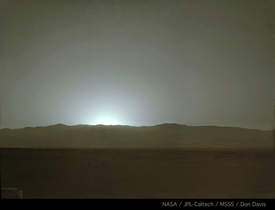
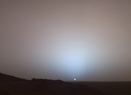
Blue Sunset

We ended last year with one of our favorite photos of the decade: an extraterrestrial sunset photographed in 2005 by the Mars Exploration Rover Spirit. We thought we'd end this year with another Martian sunset. This one was captured last month by Spirit's twin, Opportunity, in a series of photographs, which the rover science team combined and enhanced to create a seamless simulated descent. A bonus footage included in the embedded video above shows the moon Phobos passing in front of the sun. Watch it with music here.
Artist-in-Residence-in-Mars
 Surely we can hope that someday NASA will grant landscape architects access to the Phoenix Mars Lander, specifically to its multi-million dollar garden ho, if only to make intentionally artistic marks on the cryoturbated terrain of Vastitas Borealis. When the spacecraft's primary goals have been achieved quite awhile back and in fact have been exceeded exponentially, surely scientists and mission administrators will universally agree then that the scientific return of its instruments — at the very near end of their operational life — can be outweighed by purely creative pursuits. If not the Phoenix, then perhaps either of the two rovers, Opportunity and Spirit. They are certainly two of the best landscape photographers working anywhere, comparable to Ansel Adams, but they could also carry on the artistic and philosophical endeavors of Michael Heizer and Robert Smithson. With their extendable rock abrasion tools, one can have a field day excavating swales in mathematically precise parallel rows that may or may not foreshadow the coming terraforming activities of terrestrial exiles. At the moment neither delineating accessibility and inaccessibility or co-opting distant terrain under one's control but perhaps soon there will be Martian ha-has marking territorial claims while simultaneously constructing views for the sole enjoyment of the privileged class in a socioeconomically stratified new world. Or with their set of wheels, one can make patterned incisions in some patch of sandy soil. They seem to recall Richard Long in the beginning but a snapshot by the Mars Reconnaissance Orbiter later reveals that they are the outlines of future cul-de-sacs. The sad origin of Martian urbanism. How about piles of rocks? Each one given names so as to weigh them down with cultural signification? Or maybe none of the above because you consider these iconographies as ancient and irrelevant vocabularies. In which case, we wait to see what you come up with.
Mars in Terabytes
 A couple of days ago, the HiRISE Team, which oversees the High Resolution Imaging Science Experiment camera onboard the Mars Reconnaissance Orbiter, released 9.9 terabytes worth of image data. Probably the most reported images are the four avalanches “caught in action,” one of which is captured in the photo above. Cameras orbiting Mars have taken thousands of images that have enabled scientists to put together pieces of Mars’ geologic history. However, most of them reveal landscapes that haven’t changed much in millions of years. Some images taken at different times of year do show seasonal changes from one image to the next; however, it is extremely rare to catch such a dramatic event in action. For more spectacular photos, you can browse through this database in retinal ecstasy. Tornado Alleys of Mars Candor & Meridiani Mars Exposed
Candor & Meridiani
Immediately after posting this photo of exposed layered deposits in Mars, I discovered these recently released images of possible landing sites for the Mars Science Laboratory. Like the earlier one, these obscenely stunning landscape photographs were taken by the High Resolution Imaging Science Experiment camera on NASA's Mars Reconnaissance Orbiter. There are 153 in all.
One wonders if the most interesting landscape photographers aren't working here on earth and are rather spaceborne or on other planets, collaborating with NASA and government contractors. Could we be in another WPA era? Are Opportunity and Spirit the new Anselm Adams? Since I couldn't resist posting just one image, there will be two this time. The first one shows the swirling geology of Candor Chasma, a major canyon of Valles Marineris; the other shows a slice of East Meridiani, though it's obviously a lost texturological work by Jean Dubuffet. Interestingly, both seem imminently palpable. If you were to decide to reach out for your computer screen, you might actually touch something other than a mechanically smooth surface. Lick it and you'll taste Martian salt. In any case, enjoy!  
Mars Weather Report
 For the afternoon of sol 956: Fair skies with wispy clouds gently drifting toward the west. Very cold.
Dunes in Mars
 From NASA's Mars Reconnaissance Orbiter: “Dunes in Proctor Crater, located in the southern hemisphere of Mars where it was winter at the time this image was taken. Scientists think the bright tones are carbon dioxide or water frost.” Many more images of Martian aeolian landscapes here.
Older Posts ——
Home
|
|
|